Design and Consultation Update – March 2021
The Warburton Mountain Bike Destination team has had their sleeves rolled up over summer, continuing our assessments for the project’s Environment Effects Statement and working through the feedback we gathered through our most recent round of community consultation.
We’ve had dozens of environmental planners and specialists ground truthing and documenting local conditions, and received over 1300 comments through recent activities like our online interactive map and community events.
We’d like to thank everyone who took the time to get involved and share their thoughts after a tough year for all in 2020.
In response to the most recent consultation feedback and our design and specialist studies work, we’re making the following updates to the project:
- Further consideration of traffic and parking needs and potential changes
- Improvements of the project at Wesburn Park to prioritise safety and reduce traffic pressures
- Further trails near those already proposed following a review of mapping
- Inclusion of two options for the iconic Drop AK trail in EES assessments and exhibition of the EES.
Have your say on the latest updates – Engagement dates
We’re running a further phase of consultation from Monday 15 March to Sunday 4 April and invite you to have your say:
- Website and online interactive map showing the updated design
- Community sessions at Warburton Waterwheel, Wednesday 24 March 4pm to 7pm and Warburton Recreation Reserve, Saturday 27 March 10am to 1pm
- Online webinar update Friday 26 March 5:30pm to 6:30pm. Please register online to attend
- Contact us: 1300 368 333 or mtb.planning@yarraranges.vic.gov.au
Latest design and consultation updates
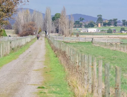
Traffic and parking assessments
Pressure on traffic and parking was the primary concern raised in recent feedback. Comments related to current pressures on roads and parking, amenity and potential safety concerns, with some participants seeking reassurance that Warburton’s infrastructure can handle increases in visitation.
With this topic continuing to come up through community feedback and with local attractions growing in popularity, the traffic assessment being done as part of the EES will look at the best way to handle increased traffic, particularly when there are peak periods as we have seen over Summer and long weekends or when community events are being held.
Prioritising safety for all
The project team is embedding safety in the design and operation of the project. We know that trails and surrounds need to be carefully managed to avoid interaction and incidents between all user groups.
Equestrians want to ensure that Wesburn Park continues to operate well and that horses and young riders aren’t impacted by mountain bike riders, sporting groups and other people using the area. Along with Equestrians, Mountain bike riders, hikers, runners and recreation visitors all want to know they can safely use the area.
Elevating the importance of Wesburn Park
We’ve been looking at more ways to address concerns about traffic and safety and identified that including additional parking with the proposed Wesburn Park trailhead would better distribute the flow of traffic and help to reduce pressure on roads and parking in Warburton.
Changes to trails based on Community feedback
The project’s fact sheet on ‘Designing and operating our network of trails’ describes the project’s five-stage design process, which includes site visits by specialists to help understand impacts, identify any differences between mapping and on-ground conditions, and refine the design.
A number of alignments in the proximity of Old Warburton (Cemetery Fireline Track/Mineshaft Hill Track) have been altered to remove conflicts with roads and move trails further from residential areas.
During on-ground assessments in late 2020, through detailed technical assessments of the trail network, Council became aware that there was an error in spatial data that resulted in an overestimation of trail length across the network. While the spatial location of the trails was accurately represented geographically, background algorithms that calculated trail length were incorrect, resulting in an approximately 20% overestimation in trail length. This meant that the proposed network was actually in the order of 145km.
A key project objective is to deliver a world-class mountain bike destination that qualifies the project for classification as a Gold Level Ride Centre under the International Mountain Bike Association Ride Centre accreditation process. This objective underpins the economic and jobs outcomes that Council is seeking as a core driver for the project. The minimum volume of trail required to meet this standard is 160km.
The project team have undertaken further planning and assessments to add approximately 30km of trails to the network to meet the 160km threshold (allowing for the potential reduction of the network by 10+km should the alternate to Drop –A- K be adopted). Planning for this additional trail was conducted in discussion with DELWP IAU and District staff and was approached under the philosophy of minimising additional ecological, heritage or social impacts.
The new trails are situated in the Yarra State Forest and predominantly within or alongside the existing geographic footprint. By using existing disturbed areas, informal tracks, and an extension of the use of Cemetery Fireline Track we have sought to further minimise impacts of the new trails. The new trails are currently undergoing all the required technical assessments to incorporate them into the EES
The requirement to add new trails has created an opportunity to provide some additional diversity to the mix of trails in the network. Steep technical climbs, designed with e-bikes and elite riders in mind, have been added to create shortcut routes to the top. Longer distance cross country trails and more challenging descents feature alongside some new beginner trail, providing something for everyone.
Drop A-K trail – two options to be assessed and exhibited
The project’s signature ‘Drop A-K’ trail would provide a 1000m vertical descent trail from the summit of Mount Donna Buang to the trailhead at the Warburton Golf Course.
The Drop-A-K trail presented during recent consultation would pass through a 2.42km area of cool temperate rainforest, due to constraints and requirements not to encroach into a crucial water catchment area.
The assessment of alternatives is a critical component of the EES and the project team are investing significant effort in this area to ensure it is a rigorous and effective process that provides for the avoidance, minimisation and mitigation of impacts while meeting project objectives.
This means that the options will undergo a thorough assessment of ecological, social and physical impacts, and will be available for review and feedback through community and stakeholder submissions on the EES.
Trail 1 (Drop-A- K), with new alignments, investigated that runs east from the summit of Mt Donna Buang. Three new trails have been identified as a package that can be considered as an alternative to the existing alignment. Work is continuing to assess the impacts and benefits of the alternate, which will be presented in the alternates report within the EES. On advice from DELWP Impact Assessment Unit (IAU), Council has decided to include both alternates through the full impact assessment and EES. This will provide the enquiry panel with the ability to make recommendations to the Minister for Planning on which alternate should progress, following the completion of the EES enquiry. Given the sensitive nature of potential impacts and the importance of the trail to project objectives, we believe this is the best strategy to deliver a rigorous and transparent process that also considers community and stakeholder input.
The new trails are shown on our interactive map at www.rideyarraranges.com.au
We would love to hear from you – tell us your thoughts about the project and if there are potential impacts we’ve missed or ways we could improve these trails.